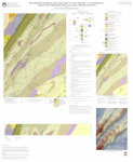
In 2014 the MGS returned to the Hudson 7.5' quadrangle to complete bedrock geologic mapping there started in 2004. This mapping focused primarily on detailed delineation subunits and structures of gneisses of the Cambrian to Ordovician Nashoba Formation based on over a decade of work in these rocks.
The new map is available at: http://mgs.geo.umass.edu/biblio/preliminary-bedrock-geologic-map-hudson-...
The map will be updated, as needed, as continuing work in adjoining quadrangles may change the location of contacts or interpretation of map scale structures.


